When thinking of untouched forests, many of us immediately go with our thoughts to the Sequoia groves in California, the magnificent mountain ash forests in Tasmania or to the endless tree stretches of Amazonia. Well, you will be surprised then to know that Europe still hosts some hidden treasures, patches of forest where signs of human impacts are minimal. Where today’s big veteran trees were young saplings at the time of the Napoleonic Wars. The good news is that we have finally mapped these forests across the entire Europe and have just published the results in the scientific journal Diversity and Distribution.
This blog was first posted in Forests & CO by Dr. Francesco Maria Sabatini, and re posted here with the author’s permission. Dr. Alejandro Ruete is co-author of the original work.
The paper ‘Where is Europe’s last primary forest?’ (freely accesible here) presents results of a huge pan-European collective effort. It took more than 2 years; we scanned 650 published scientific papers, sent questionnaires to more than 130 researchers across 30 European countries, and finally established a network of 35 researchers from all over Europe. Harmonizing and standardizing all this information was no easier task. In the end, the map of primary forests we produced includes more than 1.4 Million hectares of ‘primary forest’, an obscure word that, to a certain extent, includes all forests indicated as old-growth, virgin, or untouched.

Distribution of primary forest patches in Europe by forest type.
Why mapping primary forests?
Primary forests are important for several reasons. First of all, because their very existence links us back with a world that is being progressively forgotten due to the ever-connected digital lifestyle of many among us. Wandering in a wild forest touches some inner chords of one’s souls, which are difficult to express with words. After experiencing a wild forest, you will look with different eyes to the orderly stands (or should I say crops) of pine trees next to your house. Not only, primary forests are fundamental pieces in the ecological mosaic, since they provide habitat for endangered species, including the last populations of European Bison or brown bear, as well as EU protected beetles (e.g., Rosalia alpina?) and birds using deadwood as a resource or habitat. In short, they can work as biodiversity strongholds in Europe’s human-dominated landscapes.
For these (and many other) reasons, a map of primary forests was badly needed, as a first step to ensure their protection. We are not the firsts to try. Respectively, 20 and 10 years ago, strictly protected forests were in the focus of two large collaborative efforts to coordinate, harmonize, and link forest research across Europe. Back then, very little information was available on the distribution of primary forests outside protected areas, though. The situation changed rapidly thanks to the wave of inventorying projects performed in the recent years, especially in eastern and southern Europe. Without the passion of hundreds of field biologists, researchers and NGO activists, producing this map was simply unimaginable.
The interest on these forests has never been so high. On one hand, it stems from some illuminated policies (e.g. the Carpathians Convention), on the other by some worrisome reports on the rate at which primary forest is being destroyed in many European regions. The last example is the widespread logging undertook in the last two years by the Polish forest service in the Unesco-protected Białowieża forest, which caused a sensation, as Białowieża is one of the last remainder of the vast primeval forest that once covered most of Europe. Although a recent ruling of Europe’s top court declared this logging illegal, the grassroot and legal fight put, again, these wild forests on the spotlight. It is therefore a good news, that following a conference organized by the NGO WildEurope, tens of other European environmental NGOs are now working together to develop a strategy for the protection of old-growth forests.
-

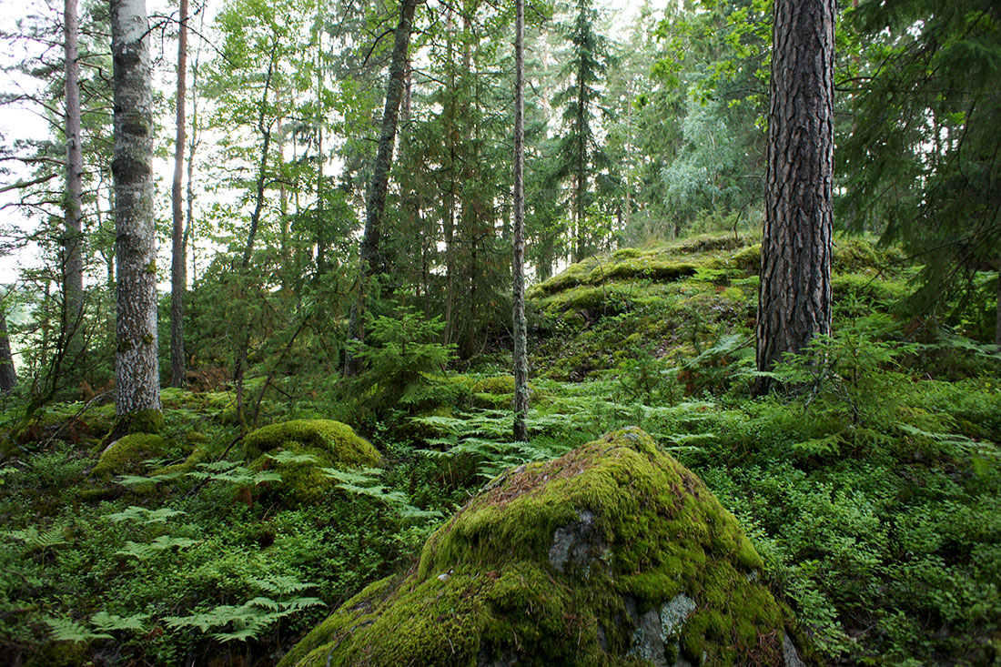
- Complexity of forest structures in ”untouched” areas are an indicator of healthy biodiversity levels.
-

- Dead trees represent an important resource for many species of fungi, beetles of insects that use them as substrate, resource or habitat. Photo: Alejandro Ruete
-

- Old living trees also offer refuge to other species in many different ways. Photo Alejandro Ruete
Still a long way to go
Of course, the map cannot be considered complete. Data quality is heterogeneous across countries, and there are some important data gaps. For instance, we did not manage to find that much data for Sweden, nor for Ireland. Given the very little amount of forest left in Ireland, we are not that worried. Much worse is not having good data for Sweden. This is one of the countries expected to host the highest fraction of primary forest. Then why no data? Actually, there is a lot of data and statistics for Swedish forests. Exploring this data and figuring out how to select and extract polygons of primary forest sounds easy, but this is a hell of a job! We are confident that in the future we will manage to engage local researchers helping us out with this task.
To solve the problem of data heterogeneity, we used a modelling approach. First, we tried to understand what characterizes the location of primary forests. Is there a general pattern behind their distribution? Why are they located where they are? Indeed, primary forests occur in the least accessible and populated areas of Europe, up in the mountains, and far away from major towns. Understanding this pattern means that we could make an educated guess of where other unmapped primary forest is likely to occur in Europe. We ran a statistical model, and tried to predict the relative likelihood of encountering a patch of primary forest across Europe.
Does it make sense? Some of it yes. We know that the Carpathians still host high fractions of primary forest, and it makes sense that the most remote regions of Finland have a high likelihood of containing wide primary forest stretches. The very high likelihood obtained for Austria, instead, is a bit worrisome, and points to the limitations of our (or should we say any) statistical model. The historical dimension of land-use must play a major role here, but history is incredibly difficult to treat statistically!
A final word of caution
The great news is that we still have some primary forest in Europe. But first, it represents only 0.7% of Europe’s entire forest area, which is clearly not much. Second, the long-term survival of primary forest cannot be taken for granted, not even in Europe. Although the majority (89%) of the primary forest mapped is in protected areas, a high fraction (54%) is currently not under strict protection. This means that, at least in some European countries, some management activities, such as timber harvesting or salvage logging may jeopardize the untouched nature of these forests. Wide patches of primary forest are being currently logged in many mountain areas, for instance in Romania or in the Balkans, often driven by our appetite for (cheap) wood, charcoal or pellets. Even within national parks, forests can still be harvested for wood in many countries. It can perhaps be done sustainably, but the wild, untouched character of the forest will be gone forever. It is time to campaign for ensuring that the protection of Europe’s last wild forests becomes a priority in the EU’s environmental strategy.
Full reference:
Sabatini, F. M., S. Burrascano, W. S. Keeton, C. Levers, M. Lindner, F. Pötzschner, P. J. Verkerk, J. Bauhus, E. Buchwald, O. Chaskovsky, N. Debaive, F. Horváth, M. Garbarino, N. Grigoriadis, F. Lombardi, I. M. Duarte, P. Meyer, R. Midteng, S. Mikac, M. Mikolas, R. Motta, G. Mozgeris, L. Nunes, M. Panayotov, P. Ódor, A. Ruete, B. Simovski, J. Stillhard, M. Svoboda, J. Szwagrzyk, O.-P. Tikkanen, R. Volosyanchuk, T. Vrska, T. M. Zlatanov, and T. Kuemmerle. Accepted. Where are Europe’s last primary forests? Diversity and Distributions. doi:10.1111/ddi.12778
Funding and support:
The work has received funding from the European Union’s Horizon 2020 research and innovation programme under the Marie Sklodowska-Curie grant agreement No 658876.
The project is entitled: ‘Co-Benefits and Conflicts between CO2 sequestration and biodiversity conservation in European Forests’ (FORESTS and CO) and received support of the European Forest Institute (EFI) under the Programme ‘Sustainability and Climate Change’, the Vegetation Science Group of Masaryk University (Brno, CZ), and the Rubenstein School of Environment and Natural Resources (University of Vermont, USA).
Further information
Link to the project: geographie.hu-berlin.de